The snow will start to fall some time in the late morning, but will be light and should not accumulate much during the day. According to everything I have read today the heaviest snow should fall between 5pm Wednesday and 5am Thursday. Below is a map from the national weather service with expected times of the snow arriving.

The winter storm warning has been expanded to include the cape.

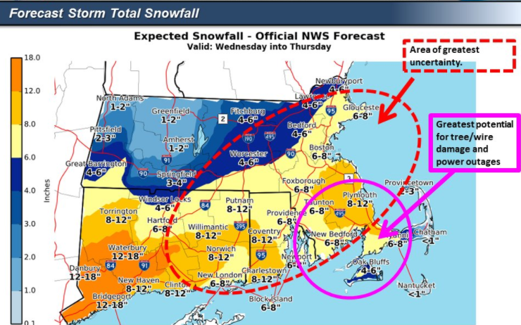
Here are the latest snowfall maps with the lower totals


I will be back tomorrow morning with another update unless things change dramatically in the next 6 hours, if they do then I will post again tonight.
No comments:
Post a Comment